
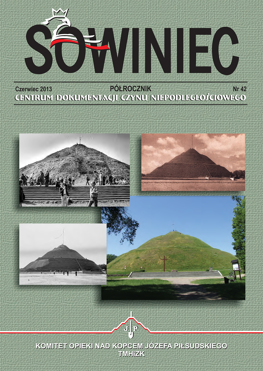
Wykorzystanie nowoczesnych technologii geodezyjnych w inwentaryzacji kopca Józefa Piłsudskiego
DOI:
https://doi.org/10.12797/Sowiniec.24.2013.42.05Słowa kluczowe:
kopiec Józefa Piłsudskiego, Sowiniec, technologia geodezyjna, geodezyjne badania kopcówAbstrakt
The mounds in Kraków belong to the category of special works of engineering in Poland due to their structure, shape and purpose. They were constructed throughout the centuries of the existence of the Polish state thanks to a series of social initiatives as objects of religious cult, places where special events or people who contributed to the formation of Polish statehood were commemorated. Today, thanks to their remarkable position, towering over the city, they constitute a perfect overlook which offers a great panorama of Kraków and the adjacent regions. Despite the fact that these structures are subject to conservatory maintenance, they are susceptible to permanent deformations of geometry. To ensure the safety of these structures they should be periodically monitored by the geodesic service and scientific institutions. Due to their very delicate and peculiar structure, the mounds are particularly susceptible to the influence of changing atmospheric conditions. The latter repeatedly caused damage of the earth structure i.e. landslides. The influence of natural forces and human activity frequently caused considerable changes in the appearance of these structures. The form of the Józef Piłsudski Mound in Sowiniec deserves special attention as the greatest structure of this kind in Poland. The study familiarises the reader with the contemporary history of the mound seen through the eyes of a geodesist thanks to the presentation of contemporary cartographic research made during the last 30 years which are preserved in the archives of the Committee for the Maintenance of the Józef Piłsudski Mound and of the Municipal Centre of Geodesic and Cartographic Documentation in Kraków. Furthermore, the author presents in his article the results of a detailed analysis of its structure with reference to decorative structures. The analysis was conducted with the aid of the most recent geodesic technology furnished by Trimble and computer technology which facilitated the parametrisation of the geometry of the structure and a representation of its current state.
Bibliografia
Główny Urząd Geodezji i Kartografii, Instrukcja G-1.9: Katalog znaków geodezyjnych oraz zasady stabilizacji punktów, Warszawa 1984.
Polska Norma – Polski Komitet Normalizacji, Miar i Jakości, PN-81/B03020: Grunty budowlane. Posadowienie bezpośrednie budowli.
Prawo ochrony środowiska, Dz. U. z 15 dnia lutego 2008 r., nr 25, poz. 150, z późniejszymi zmianami.
Propozycja zwieńczenia kopca, „Dziennik Polski” 2007, nr 83.
Ustawa z dnia 23 lipca 2003 r. o ochronie zabytków i opiece nad zabytkami, Dz. U. z dnia 17 września 2003 r., nr 162, poz. 1568, z późniejszymi zmianami.
Ustawa z dnia 7 lipca 1994 r. Prawo budowlane, Dz. U. z 1994 r., nr 89, poz. 414, z późniejszymi zmianami.
Adamczewski J., Kraków od A do Z, Warszawa 1986.
Fischer I., Historia kopca Józefa Piłsudskiego na Sowińcu, cz. 1: Od pomysłu do śmierci patrona, „Sowiniec” (Kraków) 2002, nr 21.
Gill G., Kopce w krajobrazie kulturowym Polski, Kraków 2002.
Gawałkiewicz R., Metodyka pomiaru i obróbki danych skaningowych w procesie modelowania na przykładzie inwentaryzacji zabytkowego Kopca Krakusa, „Przegląd Budowlany” 2007, nr 7-8.
Gawałkiewicz R., Od ogółu do szczegółu – tachimetr skanujący Trimble VX DR plus w inwentaryzacji zabytkowych obiektów geotechnicznych, „Geodeta” 2011, nr 11.
Kleczkowski A., Osuwiska i zjawiska pokrewne. Terminologia, charakterystyka zjawisk, przyczyny powstawania, metody badań, klasyfikacja, literatura, Warszawa 1955.
Supergan F., Bojownikom o wolność – Naród, nakł. autora, Przemyśl 1932.
Toś C., Wolski B., Zielina L., Zastosowanie tachimetru skanującego w praktyce geodezyjnej, „Czasopismo Techniczne” R. 107, 2010, z. 16.
Wolski B., Monitoring metrologiczny obiektów geotechnicznych, Kraków 2006.
http://www.geodezyjny.soteshop.pl/punkt pomiarowy-graniczny-plastmark-40cm-50cm.html
http://www.krakow.friko.pl/remont_kopca_pilsudskiego.html
http://www.krakow.travel/przewodnik/zwiedzamy-krakow/kopce
http://www.krakow4u.pl/kopiec_pilsudskiego.html
http://www.mmkrakow.pl/378767/2011/7/13/kopiec-pilsudskiego-zamkniety
http://www.polskalokalna.pl/raport/poludnie-polski-walczy-z-woda
http://www.sowiniec.com.pl/php/8_o_sowincu
http://www.upload.wikimedia.org/wikipedia/commons/3/3c/Kopiec_Pi%C5%82sudskiego_1938.jpg
http://www.wiadomosci.wp.pl/Ziemia-ze-Smolenska-juz-zlozona-w-Kopcu-Pilsudskiego
Pobrania
Opublikowane
Numer
Dział
Licencja
Prawa autorskie (c) 2013 Rafał Gawałkiewicz

Utwór dostępny jest na licencji Creative Commons Uznanie autorstwa – Użycie niekomercyjne – Bez utworów zależnych 4.0 Międzynarodowe.

